Table Of Contents
- Why Groundwater Data Matters Before Work Begins
- What Groundwater Data Is Collected
- Building A Clear Site Model
- How Data Shapes Project Design
- Tracking Water Quality And Contamination Risks
- Using Monitoring And Models Together
- Common Groundwater Planning Mistakes
- A Practical Groundwater Study Workflow
- Common Questions About Groundwater Data
- Conclusion
Across Arizona, mines, highways, utility corridors, industrial facilities, and expanding communities often share the same hidden constraint: groundwater. Beneath desert basins, mountain foothills, and alluvial valleys, water can move through soil, sediment, fractures, and rock layers in ways that are not obvious from the surface. Understanding those conditions early helps project teams make choices that fit the site rather than relying on assumptions.
A sound hydrogeology program gives decision-makers a clearer view of water levels, likely flow paths, recharge, and water quality before excavation or construction changes the system. This matters in Arizona, where groundwater supports many uses and water planning can affect both project feasibility and nearby wells, washes, springs, and habitat. Professional guidance on hydrogeology and site characterization is available from firms like Rock Engineering Ltd., which specializes in hydrogeology services.
Why Groundwater Data Matters Before Work Begins
Groundwater conditions can influence foundation performance, excavation stability, tunnel inflows, road drainage, dewatering needs, and the design of mine workings. A site may look dry during initial drilling but encounter substantial inflow when excavation reaches a permeable gravel layer or fractured bedrock zone. Water levels can also rise and fall with rainfall, seasonal recharge, pumping, and changing surface-water conditions.
Early investigation can identify these issues while designs are still flexible. That creates more time to compare options, estimate pumping and treatment needs, protect nearby water users, and establish practical monitoring plans. In Arizona, the state’s groundwater management areas illustrate why long-term water conditions are an important consideration for development and infrastructure decisions.
What Groundwater Data Is Collected
Reliable groundwater decisions are based on several lines of evidence, not a single water-level reading or laboratory sample. Typical field programs collect:
- Groundwater elevations from monitoring wells and piezometers.
- Geological logs describing soil, sediment, rock, faults, and fractures.
- Hydraulic testing results indicate how readily water moves through materials.
- Rainfall, recharge, streamflow, and drainage information.
- Water temperature, field chemistry, and laboratory water-quality results.
- Pumping records, slug-test results, and observations from nearby wells.
Each data set answers a different question. Together, they help show where water is stored, how it may move, and how a project could affect local conditions.
Building A Clear Site Model
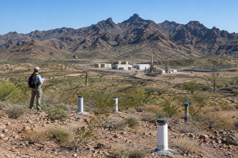
A conceptual site model is a practical explanation of how groundwater behaves at a specific location. It brings maps, topography, drilling logs, water levels, field observations, and chemistry into one working picture. Effective site characterization helps distinguish permeable zones from lower-permeability layers, identify likely recharge and discharge areas, and clarify possible connections to washes, springs, wetlands, or wells.
The model should identify confirmed information, working assumptions, data gaps, and uncertainty. It is not a static drawing. As drilling, sampling, or monitoring produces new evidence, the model should be revised so that future decisions reflect the best available understanding of the site.
How Data Shapes Project Design
Groundwater findings can shape project design well before final plans are issued. They may help teams:
- Set excavation depths, slopes, support needs, and construction stages.
- Design drainage, seepage-control, dewatering, or depressurization systems.
- Choose appropriate locations for supply wells, monitoring wells, and water infrastructure.
- Protect nearby wells, surface-water features, and environmentally sensitive areas.
- Estimate water storage, treatment, discharge, and contingency requirements.
- Prepare for wetter periods, drought, changing operations, or additional pumping.
Beginning this work during site selection is often more useful than waiting until layouts and construction methods are already fixed. Earlier data gives teams more room to avoid difficult conditions instead of only responding to them.
Tracking Water Quality And Contamination Risks
Water quantity and water quality are related but distinct issues. A well can produce enough water for construction needs while still containing naturally occurring dissolved minerals that require management. Disturbed rock, fuel storage, process water, waste materials, saline zones, and accidental releases can create additional concerns that require careful controls.
Baseline sampling before major construction or mining begins is essential because it documents existing conditions. Repeated sampling can then show whether changes are seasonal, naturally variable, or potentially connected to project activity. Dissolved chemicals and gases found in groundwater may come from natural geologic materials or human activities, which is why interpretation should consider both site geology and land use.
Clear trigger levels and response steps make monitoring more useful. A plan should state who reviews results, what constitutes an unusual condition, what confirmation sampling is needed, and what actions will follow.
Using Monitoring And Models Together
Groundwater models can estimate drawdown, seepage, water balances, or the movement of dissolved constituents under different conditions. However, a model is only as useful as its inputs and assumptions. Monitoring data provides the real-world check: if measured water levels or flows differ from simulated results, the model may need adjustment.
Useful scenarios include intense rainfall, prolonged dry periods, deeper excavation, higher pumping rates, changes in recharge, or the addition of a new well. Testing several plausible conditions is generally more informative than relying on one predicted outcome. Updated monitoring and modelling support adaptive decisions as a project progresses.
Common Groundwater Planning Mistakes
- Starting fieldwork after major design choices have already been made.
- Using too few monitoring points to understand site variability.
- Collecting measurements during only one season.
- Overlooking nearby wells, springs, washes, or drainage features.
- Treating groundwater and surface water as entirely separate systems.
- Relying on historic records without confirming present conditions.
- Building a complex model before basic field data is adequate.
- Monitoring results without defining the action that each result should trigger.
For example, an unrecognized fracture zone can lead to unexpected excavation inflows. The result may be added pumping, treatment requirements, schedule disruption, and redesign. A focused investigation cannot remove every uncertainty, but it can reveal the questions that need to be managed.
A Practical Groundwater Study Workflow
- Define the decision. Identify the design, permitting, operational, or environmental question the study must answer.
- Review available information. Gather maps, well records, geology, climate information, and prior reports.
- Plan field work. Select monitoring locations, sampling points, tests, and survey needs.
- Collect baseline data. Measure water levels, flow conditions, and water chemistry before major disturbance.
- Develop the site model. Connect groundwater, geology, surface water, and planned project features.
- Test scenarios. Consider normal, wet, dry, high-pumping, and upset conditions.
- Set monitoring targets. Define locations, timing, thresholds, documentation, and responsibilities.
- Update the plan. Refine designs and controls as new information becomes available.
Common Questions About Groundwater Data
How Long Does A Groundwater Study Take?
Timing depends on site size, geology, project stage, seasonality, permitting needs, and the amount of baseline information already available.
Is One Monitoring Well Enough?
Usually not. Multiple locations and repeated measurements are more likely to reveal differences across a site and changes over time.
Can Conditions Change After Construction?
Yes. Excavation, pumping, rainfall, drought, land-cover changes, and nearby water use can alter local groundwater conditions.
When Is A Groundwater Model Useful?
Modelling is valuable when a project needs to compare future scenarios, estimate drawdown, evaluate seepage, or assess potential movement of water-quality constituents.
Conclusion
Groundwater data is more than a technical requirement for Arizona mine and infrastructure projects. It is a decision tool that supports safer designs, clearer environmental planning, realistic water management, and faster responses to changing conditions. By collecting credible baseline information early and updating it throughout the project life cycle, teams can reduce surprises below ground and make better decisions above it.